CCCL Disclosure for Santa Rosa Beach Gulf-Front Property
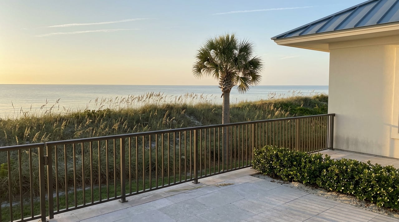
"Right now anything of the ECL seaward is public beach," Walton County Commissioner Dan Curry told a local news crew last year, as WJHG reported, standing on a stretch of coastline the county is actively re-measuring. He was talking about a line most gulf-front buyers on Santa Rosa Beach never think to ask about, because for most of this market's history it sat still.
That line, the Erosion Control Line, is not the same line that governs whether you can rebuild a gulf-front home or add a second story. That's the Coastal Construction Control Line. The two get treated as interchangeable in casual conversation on 30A, and the confusion rarely costs anyone anything, until it does: at a closing table, during a renovation permit application, or when a seller describes a listing as having "private beach" without knowing exactly how much of that beach is legally theirs. Right now, with Walton County mid-survey on a renourishment project and a 2025 state law reshaping how the boundary works, the distinction matters more than it has in years.
The Coastal Construction Control Line is a state regulatory line administered by the Florida Department of Environmental Protection. It is not a property boundary. It overlays gulf-front parcels and determines what you're allowed to build, rebuild, or add onto seaward of it, based on modeling of what a 100-year storm would do to the dune system. Florida law also requires that any contract for property fully or partially seaward of the CCCL include a specific disclosure to the buyer, a requirement spelled out in section 161.57 of the Florida Statutes.
The Erosion Control Line is a different animal entirely. It marks where private ownership ends and public beach begins after a nourishment project places new sand on the shoreline. It has nothing to do with what you can build. It has everything to do with who can legally sit, walk, and set up a chair in front of your house.
Santa Rosa Beach owners who've held gulf-front property for a decade or more have mostly never had to separate these two concepts, because Walton County hadn't formally established an ECL along most of its coastline and the CCCL hadn't been revisited in years. Both of those facts changed starting in 2025.
Because the CCCL is based on erosion modeling rather than a fixed survey, the Florida Department of Environmental Protection can and does re-establish it when a county's shoreline changes dramatically after historic erosion or major storms.
Walton County's own building division walks through the documentation required for any project seaward of the line, including a boundary survey showing the CCCL, the mean high-water mark, and site contours, because the agencies involved want to see exactly where a proposed footprint falls before they'll sign off.
| Coastal Construction Control Line (CCCL) | Erosion Control Line (ECL) | |
|---|---|---|
| Set by | Florida Department of Environmental Protection, based on storm erosion modeling | State survey establishing the mean high-water line for a renourished segment |
| Governs | What you can build, rebuild, or add onto | Where private ownership ends and public beach begins |
| Can it move | Yes, through formal FDEP reestablishment after major erosion or storms | Yes, and Walton County is actively surveying toward one now |
| What it means for an owner | Rebuild limits, permit requirements, disclosure duty at contract | How much of the sand in front of the house stays private |
Walton County has spent 2025 and 2026 laying the groundwork for its first countywide Erosion Control Line, and the timeline is worth knowing if you're transacting on gulf-front property here. As Get the Coast reported, the push started with a 2025 state law, Senate Bill 1622, which repealed an earlier statute that had blocked Walton County from enforcing its own customary-use ordinance. That earlier law had applied almost by accident: it exempted beach access ordinances adopted before January 2016, and Walton County's ordinance had been adopted in October 2016, missing the cutoff by nine months and leaving the county in a legal position no other Florida coastal county shared.
SB 1622 also set the mechanism for how a new ECL gets drawn on nourished beaches: the erosion control line is established at the mean high-water line, determined by survey, for each renourished segment.
"Any new sand placed seaward of the erosion control line becomes public beach by law."
As quoted in a Get the Coast report, Destin Mayor Bobby Wagner described the practical effect when the bill passed. Walton County has since secured more than $60 million in local funding through its beach renourishment sales tax, matched by more than $60 million in federal funds through the hurricane storm damage reduction program, to fund the physical nourishment work. The surveying that has to happen before any sand gets placed is already underway. The Army Corps of Engineers' contractor completed topographic surveys of the beach in April 2026 and finished the water-side hydrographic surveys in May 2026, with sand sampling done to confirm compatibility with borrow sites. As of the county's most recent public update in June 2026, that data was still being turned into a revised design plan, with no construction date set.
Here's the part that surprises even longtime 30A owners once they understand how the mechanism actually works. When a renourishment project adds sand to a beach, that new sand doesn't automatically extend a private owner's lot seaward. Under the framework SB 1622 sets up, any sand placed seaward of the newly surveyed mean high-water line becomes public beach by law the moment it's placed.
That means a gulf-front property that gets a wider, more storm-resilient beach after renourishment isn't necessarily gaining private beachfront depth. The dune system in front of the house may be healthier, the storm buffer may be better, and the view may improve, but the legal boundary between private and public can end up sitting closer to the house than the physical sand suggests. For a seller marketing a listing's "private beach," this is worth getting right before it goes in a listing description. For a buyer comparing two gulf-front homes, one on an already-nourished segment and one still waiting on the county's project, the private footprint each actually conveys can differ from what a walk on the sand implies.
If my home is landward of the CCCL, am I in the clear? Being landward of the CCCL removes the state disclosure trigger, but Walton County's own coastal setbacks, dune protection rules, and flood elevation requirements still apply independently, and those can be more restrictive than the state line in certain stretches.
When will renourishment actually happen on my segment? As of the county's most recent update, the engineering data was still being converted into a design plan, with no construction date set. Owners on segments not yet scheduled should expect this to remain a multi-year process.
Gulf-front property on Santa Rosa Beach rewards owners who understand exactly which lines apply to their lot and which ones are about to move. If you're evaluating a gulf-front purchase or preparing to list one, Emerald Coast Properties can walk through the specific CCCL status, disclosure requirements, and renourishment timeline that apply to that address. Schedule your complimentary consultation with Howard B. Dolgoff to get a clear read before you write or accept an offer.
This article is general information, not legal, tax or financial advice. Consult a qualified professional about your situation.
Stay up to date on the latest real estate trends.
Our team of professionals will be with you every step of the way, from preparing your home for the sale to handing the keys to the new buyer.